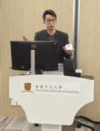
On 9 September 2024, Prof. Ronald Po, visiting scholar from CUHK-CCK Asia Pacific Centre’s Young Scholars Visiting Schemes, was invited to deliver a lecture regarding the maritime history during the Qing dynasty in the eighteenth century.
Prof. Po is a historian of late imperial China from the fourteenth to the early twentieth centuries. Since completing his doctorate at Universität Heidelberg in 2013, he has taught in Germany, the United States, and Canada, and is currently an associate professor of the Department of International History at the London School of Economics and Political Science.
During the lecture, Prof. Po shared that there were many unnamed and unidentified individuals who contributed to recording China’s maritime frontier. Using various illustrations of diagrams as examples, such as “Diagram of harbors and checkpoints (汛口圖)”, “Diagram of boundary lines (界址圖)”, and “Diagram of inner and outer seas (內外洋輿圖)”, Prof. Po explained that these cartographers were thorough in their work, meticulously surveying and documenting the microecologies and micro-geographies of the Qing’s maritime frontier. Thanks to this, we are able to identify strategic locations and efficient transportation routes on the diagrams, as well as clearly demarcated boundaries. Their work provided valuable resources for understanding the diverse and complex maritime environment of the Qing dynasty.
Prof. Po concluded that the diagrams illustrated by unnamed cartographers reveal the Qing dynasty’s extensive connection to the maritime world, highlighting its significant maritime presence and active involvement in maritime activities along the coastline. This challenges the traditional view of the Qing dynasty as primarily land-focused. |