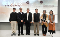
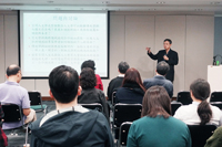
Co-organised by the Institute of Chinese Studies, the CUHK-CCK Asia-Pacific Centre for Chinese Studies and the CUHK Library, the public lectures series of Digital Humanities and Chinese Studies were held on 7 & 10 January 2020. It was an honour to have Prof. Fan I-chun and Mr. Liao Hsiung-ming from Centre for Geographic Information Science, Academia Sinica (Centre for GIS) to share with us how geographic information system facilitated the studies of Chinese culture.
Prof. Fan I-chun, Executive Director of the Centre for GIS, delivered the first talk, “From Spatio-temporal GIS to GeoHumanities”, on 7 January 2020.
Prof. Fan received his doctorate from Stanford University. His research interests include Ming-Qing socio-economic history and Geographic Information Systems. The former involved exploring China’s trade from the nineteenth and twentieth centuries to the pre-modern period. The latter is dedicated to the development and promotion of the GIS system since the 1980s. This exploration and development has been widely implemented in the fields of humanities and social sciences including history, religion and society, so-called GeoHumanities.
GeoHumanities is a new field combining digital humanities and geographic information science. In the lecture, Prof. Fan shared from an academic perspective how to implement the technologies of geographic information science by integrating time, places, textual data, various maps and photos to effectively display multiple perspectives of Spatial Humanities. Prof. Fan explained that this technology can not only serve as a basic framework for recreating historical scenes, but also utilize multiple system models of management, analysis, integration and presentation of spatio-temporal information to continuously collect, expand and integrate various original information and researches.
The second lecture was held on 10 January 2020. Mr. Liao Hsiung-ming, Assistant Research Specialist from the Centre for GIS, share his insights on the topic, “The Cyber Infrastructure for Geo-Humanities and the Study of Environmental History Based on HGIS”.
Mr. Liao’s research areas cover Geographic Information Science, Digital Archives and Digital Humanities. He is currently Assistant Research Specialist at the Centre for GIS. With more than 20 years’ experience in GIS development, Mr. Liao explores the possibility of value-added applications of archives. In recent years, Mr. Liao has worked closely with Prof. Fan in developing and promoting the application of GIS in Humanities and Social Sciences.
Mr. Liao explained in the lecture that historical GIS like Chinese Civilization in Time and Space (CCTS) can be regarded as a virtual spatio-temporal information framework that can be applied to convert unstructured historical literature into numerical coordinates or link space-time relationship between different textual materials. CCTS is developed by the Centre for GIS, Academia Sinica, as a historical GIS platform of a large number of Chinese historical gazetteers. On this basis, the research methods of digital humanities and the study of environmental history that involve using spatio-temporal tools for visualization and analysis can become a new research domain known as GeoHumanities or Spatial Humanities. |


