

![]() 03 Jun 2008,
Issue 23
03 Jun 2008,
Issue 23


 |
 |

| Remote Sensing Technologies Save Lives from Sichuan Earthquake | |
| Tens of thousands were killed, many more injured and widespread destruction was reported as a result of the Sichuan Earthquake. With the help of the state-of-the-art remote sensing technologies, academics of CU have helped save lives from the devastating earthquake. | |
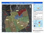
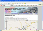
Subsequent to the disaster, the Institute of Space and Earth Information Science (ISEIS) of CU have acquired remote sensing images of the affected area from various channels. Analyses have been made to the geographic data gathered so as to identify possible post-disaster natural hazards for development of evacuation plans as a way to minimize casualties. ISEIS also set up a special webpage assessing the impact caused by the earthquake in Sichuan province. Information provided on the page, including map and remote sensing images of the disaster area as well as assessment of potential population affected by the earthquake, is updated regularly and has been passed to the rescuing units of the Mainland with an aim to assist formulation of developmental plans to help in rehabilitation of the area. ISEIS is the only national base for satellite remote sensing in Hong Kong. Its research areas include Cloud-prone and Rainy-areas Remote Sensing (CARRS), Virtual Geographic Environments (VGE), emergency response and natural disaster monitoring and management, urban and metropolitan GIS etc. For more details of ISEIS, please visit: http://www.iseis.cuhk.edu.hk/eng/.
|
|
| Top | |
Please send enquiries,
suggestions and contributions to cu.aao@cuhk.edu.hk
Copyright © 2025. Alumni Affairs Office, CUHK
Rm 301, 3/F, John Fulton Centre,
The Chinese University of Hong Kong
Tel: 2609 7861 Fax: 2603 6226